
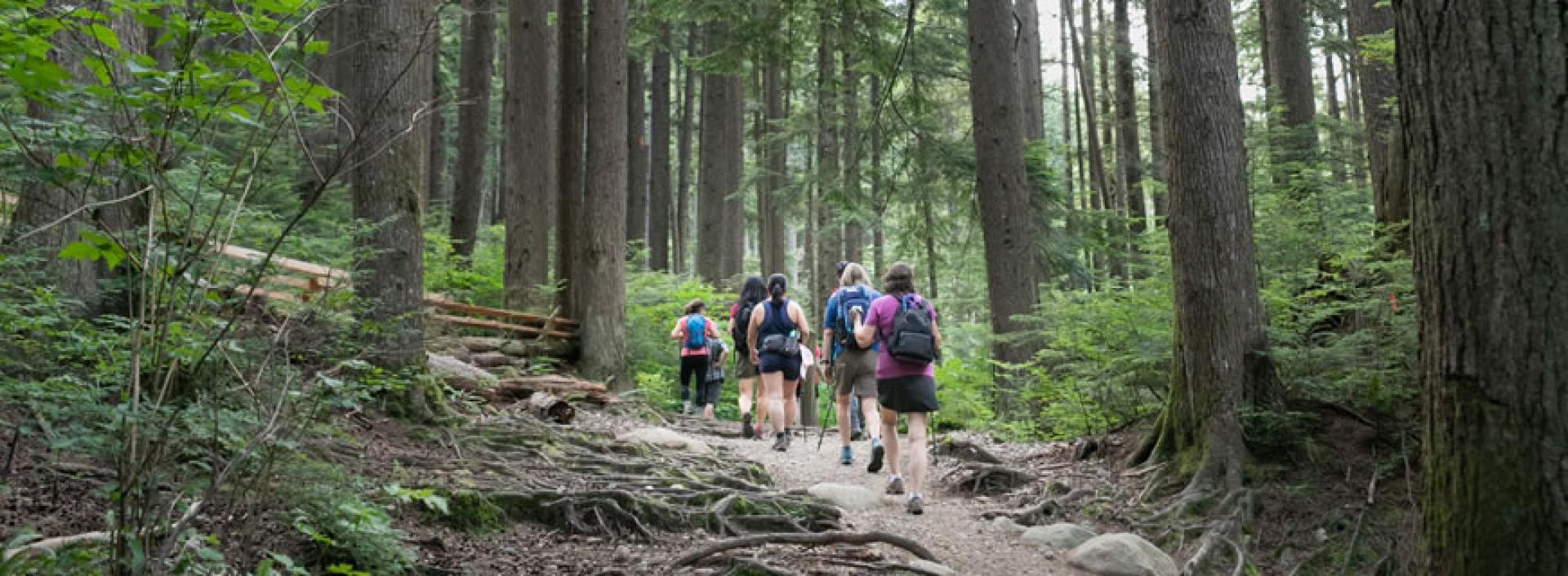
Hikes on the North Shore
Established in 1989, this fun and lively hiking group explores the many trails of the North Shore.
Trail Trekkers hikes are included with an NVRC Active Pass. If you don't have an Active Pass, you can pay a fitness day visit fee.
Participants should have good hiking shoes/boots (no runners), a fanny/day pack, appropriate clothing for weather conditions, water plus a flashlight or headlamp for evening hikes. No umbrellas and no dogs are permitted.
Advance registration is required for all hikes and walks. Register online using the links below or call 604-987-7529. Registration for the following week's hikes opens on Tuesdays at 7am.
Routes may be subject to change for safety reasons (dependent on weather and trail conditions). Hikes are approximately two hours long, but see hike description for full details.
| Walk/hike ratings | |
|---|---|
| Easy | Little to no elevation gain. No steep hills or obstacles. Even footing and very little loose gravel, large rocks or roots. |
| Moderate | Up to 250 metres elevation gain. Distance 4-15 km. Some basic trail experience needed. Need proper equipment and water. There may be stairs and obstacles like fallen trees. No longer than two hours, unless stated. Moderate changes in elevation. Some short steep sections. |
| Intermediate | From 250-350 metres elevation gain. Distance 4-15 km. Some trail experience needed. Need proper equipment and water. Different surface types. May be longer than two hours. Significant changes in elevation with long, steep sections. |
| Strenuous | More than 350 metres elevation gain. Distance 4-15 km. Trail experience needed. Need proper equipment and water. Challenging terrain. May be longer than two hours. |
-
Guide: Sharon
Date Meeting Place Hike Registration Jun 1 Meet at Douglas Woodward park, WV, take exit 11 (15th Street) from Hwy 1, right at stop sign onto Cross Creek, take next left onto Tyrol, take next right on 15th St. and then left on Camelot, parking lot is at end of street where meets with Camwell (directions- 1389 Camwell). Lookout on Cypress Bowl Rd via Millstream
Intermediate hike to a great viewpoint, 5.4 km & 291m elevation gain.Registration closes at 9:45am on the day of the hike.
Jun 8
6:30pmMeet 6:30pm at the Parkgate Community Centre, Banff Court, to carpool to Baden Powell trailhead (between Km 2 & 3 on Mt. Seymour Road - limited parking). 3 Chop & Old Buck Loop
Intermediate/Strenuous with very steep uphill, 5.5 km & 388m elevation gain.Registration closes at 9:45am on the day of the hike.
Jun 15 Meet at the Caulfeild Village Shopping Centre (here), near north entrance. Sahalee Loop
Intermediate hike, 7.2 km & 306m elevation gain. For those not familiar with the trail there are several stretches of steep uphill.Poles are suggested for the rocky and rooty terrain (typical West Coast hike).
Registration closes at 9:45am on the day of the hike.
Jun 22 Meet Millstream and Henlow parking (here). Lost Lake from Millstream
Strenuous hike to a beautiful mountain lake. Hike will take about 2.5 hours, 7.6 km & 412m elevation gain.
Bring poles for the downhill.Registration closes at 9:45am on the day of the hike.
Jun 29 Meet outside the End of the Line General Store, 4193 Lynn Valley Rd. (directions). Two Canyon Loop (aka stairmaster)
Intermediate and longer than 2 hours with stairs, 9 km & 323m elevation gain.Registration closes at 9:45am on the day of the hike.
Jul 6 Meet outside the End of the Line General Store, 4193 Lynn Valley Rd. (directions). Lynn Loop via Varley
Moderate with steep stair section, 8.7 km, 225m elevation gain.Registration closes at 9:45am on the day of the hike.
Jul 13 Meet outside the End of the Line General Store, 4193 Lynn Valley Rd. (directions). Fishermans, Homestead, Rice Lake
Moderate hike with several stairs, 8.7 km & 205m elevation gain.Registration closes at 9:45am on the day of the hike.
Jul 20
6:30pmMeet at corner of Mtn. Hwy and Coleman (look for more than 2 hr parking) (here). It is a 12-minute walk and about 850m to the trailhead from here. Big Cedar Tree with Lynn Creek crossing
Intermediate hike, multiple creek crossings, rocks, roots and one gully descent via rope, 7.9 km & 248m elevation gain.Poles are strongly suggested for crossing the creek.
This hike is just over 3 hrs, bring flashlight.Registration closes at 9:45am on the day of the hike.
Jul 27 Meet at top of Skyline and Powerline Trail (here). Skyline Trail to USAF Plane Wreck
Short but Strenuous (very steep!) out and back hike - bring poles, 4 km & 448m elevation gain.Hike to plane wreck memorial (info) and back down.
Registration closes at 9:45am on the day of the hike.
Aug 3 BC Day - No hike Aug 10
6:30pmMeet at the Parkgate Community Centre, Banff Court to carpool up Mt. Seymour Rd. at 6:30pm.
Option to meet at the Deep Cove Lookout parking lot - 9.2 km up Mt. Seymour Road (here) at 6:45pm.Perimeter Trail to Goldie Lake on Mt. Seymour
Moderate hike with rocks, roots and a small scramble to 2 pretty mountain lakes, 5.2 km & 214m elevation gain.Registration closes at 9:45am on the day of the hike.
Aug 17 Meet at the corner of St. Mary’s and Wooddale (here). St. George’s to Lower Mosquito Waterfall & Old Growth Forest
Moderate hike with some scrambling and deadfall hike to lower Mosquito Creek waterfall, cross over creek to old growth forest and return via Powerline. Some steep sections, 5 km & 236m elevation gain.Registration closes at 9:45am on the day of the hike.
Aug 24 Meet at the Hollyburn cross-country area by the kiosk (here) just before the ski rental buildings. Washrooms are a short walk away. 3 Lakes & Cabin Loop at Hollyburn
Moderate hike to 3 beautiful mountain lakes - Blue Gentian, First and West lakes. Some rooty and gravelly sections, 6.3 km & 187m elevation gain.Registration closes at 9:45am on the day of the hike.
Aug 31 Meeting at the Hyannis Baden Powell Trailhead, west of Berkley (here). Seymour Canyon Loop from Hyannis
Intermediate hike with a steep staircase near the start, 7.8 km & 272m elevation gain.
We will cross Seymour Canyon on the Pipeline Bridge and the Seymour River Suspension Bridge.Registration closes at 9:45am on the day of the hike.
* Wear good walking or hiking shoes/boots - no running shoes. Dress for the weather. Bring hydration and snack. Please bring a flashlight or headlamp.
-
Date Meeting Place Hike Registration Jun 3 Meet at Millstream Brothers Creek Trailhead (directions). The Candelabra Tree
Strenuous steep rocky, rooty trail, 5.8 km and 376m elevation.
This hike will be 2.5 hours.
Registration closes at 12:30am on the day of the hike.
Jun 10 Meet at Old Buck parking lot on Ann MacDonald Way (directions). Raindancer and Old Buck Loop
Intermediate hike, 6.8km, 292m elevation gain.Registration closes at 12:30am on the day of the hike.
Jun 17 Meet at the Gleneagles Community Centre, gravel parking lot, 6262 Marine Dr (directions). Eagle & Fisherman’s Bluffs via Seaview
Moderate with steep, uphill sections, 6.5 km & 240m elevation gain.Registration closes at 12:30am on the day of the hike.
Jun 24 Meet 9:30am at the Old Growth Parking lot (directions) OR meet at Cypress Pop-up at 9:15am for carpooling. Cypress Old Growth loop
Intermediate hike, 5.4 km 246m elevation gain.Registration closes at 12:30am on the day of the hike.
Jul 1 No hike - Canada Day Jul 8 Meet at Cleveland Dam (here). Capilano Hatchery
Moderate hike on trails and roads, 8.3 km & 160m elevation gain.Registration closes at 12:30am on the day of the hike.
Jul 15 Meet at 9:15 at the Parkgate Community Centre (here) to carpool to Baden Powell trailhead between Km 2 & 3 on Mt. Seymour Road. 3 Chop & Old Buck Loop
Strenuous as all the uphill is at once, 5.6 km & 388m elevation gain.Registration closes at 12:30am on the day of the hike.
Jul 22 Meet at the top of Prospect Road (here). Cascades & Dreamweaver
Intermediate to strenuous hike. 5.1 km & 282m elevation gain. A steady, technical uphill along the east side of Mosquito Creek with logs to over/under.Registration closes at 12:30am on the day of the hike.
Jul 29 Meet at Old Buck parking lot on Ann MacDonald Way (here). Raindancer and Old Buck Loop
Intermediate hike, 6.8 km & 288m elevation gain.Registration closes at 12:30am on the day of the hike.
Aug 5 Meet on the Lynn Headwaters Park road before the pay parking (here). Cedar Tree - Lynn Creek Crossing
Moderate hike, 8.1 km & 250m elevation gain. Longer with multiple creek crossings, rocks roots and one gully descent via rope. Bring water shoes and poles for the Lynn Creek crossing. This hike will be 3 hours.Registration closes at 12:30am on the day of the hike.
Aug 12 Meet at Millstream road and Eyremount Drive (directions). Blue Gentian Lake
Strenuous long continuous uphill, 6.6 km & 441m elevation gain. Longer than 2 hours.Registration closes at 12:30am on the day of the hike.
Aug 19 Meet at 9:10am at the Parkgate Community Centre (here) to carpool to the top of Seymour parking lot by the trailhead (here). Mystery Lake Loop
Moderate hike with roots and rocks, 4.5 km & 256m elevation gain.Possible swim bring a bathing suit.
Registration closes at 12:30am on the day of the hike.
Aug 26 Meet at Millstream Brothers Creek Trailhead (here). The Candelabra Tree
Strenuous steep rocky, rooty hike, 5.8 km & 376m elevation gain. This hike will be 2.5 hours.Registration closes at 12:30am on the day of the hike.
* Wear good walking or hiking shoes/boots - no running shoes. Dress for the weather. Bring hydration and a snack.pr
-
Date Meeting Place Walk Registration Jun 5 Meet at the corner of St. Mary’s and Wooddale (directions). St. George's Area Trails to Waterfall via Skid Road
Intermediate hike with a rope climb and some stairs and rooty sections, 6 km & 283m (waterfall/rope).Registration closes at 12:30am on the day of the hike.
Jun 12 Meet at Woodley and Northwood Dr., park on street or in parking spots (directions). Cypress Falls from Northwood Dr., Intermediate hike to 2 waterfalls with some steep sections, 5.3 km & 287m elevation gain. Registration closes at 12:30am on the day of the hike.
Jun 19 Meet at Myrtle Park in Deep Cove, go east on Mount Seymour Parkway, turn left on Deep Cove Road, turn right on Cliffmont Road, turn right on Caledonia Road. The road curves to the left and becomes a parking area (directions) . Quarry Rock from Myrtle Park
Moderate/Intermediate hike through the forest with some steep sections and stairs, 6.3 km & 248m elevation gain.Registration closes at 12:30am on the day of the hike.
Jun 26 Meet at the Parkgate Community Centre, Banff Court to carpool up at 9:15am (directions) Perimeter Trail to Goldie and Flower Lakes, Mt. Seymour
Moderate forest hike to 2 pretty mountain lakes (one scramble and lots of rocks and roots), 5.6 km & 229m elevation gain.
Registration closes at 12:30am on the day of the hike.
Jul 3 Meet at the Parkgate Community Centre (directions). Bridal Path, Mary Kirk &Golf Course Trails
Moderate hike on rocky and rooty trails, 7.3 km & 187m elevation gain.Registration closes at 12:30am on the day of the hike.
Jul 10 Meet at the Caulfeild Village Shopping Centre (here), near north entrance. Sahalee, Intermediate hike
7 km & 290m elevation gain.Poles are suggested for the rocky and rooty terrain.
Registration closes at 12:30am on the day of the hike.
Jul 17 Meet Douglas Woodward Park (here - 1389 Camwell). Douglas Woodward Park to Cypress Lookout
Intermediate hike to viewpoint, 6.2 km & 302m elevation gain.Registration closes at 12:30am on the day of the hike.
Jul 24 Meet at the Baden Powell trailhead on Hyannis Drive, west of Berkley (here). BP, Bridal, Greenland, Bottletop from Hyannis
Moderate hike with rooty sections and lots of beautiful green forest trails, 6 km & 186m elevation gain.Registration closes at 12:30am on the day of the hike.
Jul 31 Meet in front of the Cypress Creek Day Lodge, 6000 Cypress Bowl Rd (here). Black Mtn & Cabin Lake
Intermediate hike to a beautiful swimming lake and mountain views, 5 km & 334m elevation gain.Bring your swimsuit and towel!
Registration closes at 12:30am on the day of the hike.
Aug 7 Meet at the Gleneagles Community Centre, gravel parking lot, 6262 Marine Drive (here). Horseshoe Bay & Whytecliff 7-Bay Loop
Intermediate hike, 8.8 km & 304m elevation gain. Hike along the beaches and trails of the many coves in the Horseshoe Bay area.Registration closes at 12:30am on the day of the hike.
Aug 14 Meet Myrtle Park in Deep Cove (here). Quarry Rock from Myrtle Park
Intermediate hike through the forest, past old growth to the Quarry Rock viewpoint, 6.3 km & 248m elevation gain.Registration closes at 12:30am on the day of the hike.
Aug 21 Meet at the Gleneagles Community Centre, gravel parking lot, 6262 Marine Drive (here). Fisherman’s Bluffs & Arbutus Forest via Seaview
Moderate hike with a some uphill sections and many viewpoints, 6.5 km & 219m elevation gain.Registration closes at 12:30am on the day of the hike.
Aug 28 Meet in front of the Cypress Creek Day Lodge, 6000 Cypress Bowl Rd (here). Bowen Lookout to Strachan Meadows at Cypress
Moderate hike with a winding steep trail to the Lookout turnoff and then the Howe Sound Crest Trail (HSCT) to the meadows, 6.4 km & 233m elevation gain.Registration closes at 12:30am on the day of the hike.